
Is Lisbon Prepared For The Next Earthquake?

I live on a hill above the sea in Estoril. My apartment is a concrete construction from the 1990s, maybe 50 meters above sea level, and the nearest beach is a ten minute walk downhill. For the past couple months I treated that walk as nothing more than pleasant, but as I look around I wonder how these people and buildings would survive another 1755 type 7.7 magnitude quake…
What I found is not a reason to be concerned. It is a reason to understand exactly what kind of place you are living in, because the answer varies enormously depending on your building, your elevation, and how close you are to the water. This coast sits atop one of Europe’s most significant seismic zones, and the preparedness infrastructure around it is real but unfinished. Knowing the difference between those two things could save your life.
The Eurasian and African tectonic plates are pressing toward each other at roughly four to five millimeters per year southwest of Portugal, roughly the rate your fingernails grow. Over centuries those millimeters accumulate into enormous stored energy, and the release of that energy is why this stretch of Atlantic coast has one of the worst histories of earthquake destruction anywhere in Europe.
There are two distinct threats here, and they are not the same.
The first is the offshore megaquake. The earthquake of November 1, 1755 was most likely generated by a massive fault structure in the Horseshoe Abyssal Plain, several hundred kilometers southwest of Portugal. It had a magnitude of 7.7 or greater and killed somewhere between 15,000 and 60,000 people depending on which scholarly estimate you accept. It destroyed most of Lisbon’s buildings and sent a tsunami across the Atlantic that was still damaging harbors in Ireland and the Caribbean. Based on what we now know about the fault structures involved, Verisk AIR’s seismic modeling group estimates the return period for a repeat of that offshore event at between 3,000 and 4,000 years. That is a long interval. The offshore megaquake is not the most statistically pressing concern for people living on this coast today.
The second threat carries a shorter fuse. The Lower Tagus Valley fault system runs directly through the Lisbon metropolitan area and has generated its own destructive earthquakes, including events in 1344, 1531, and 1909. Verisk AIR found that the return period of magnitude 6 to 7 earthquakes along this fault could be as short as 150 to 200 years. The last significant event was in 1909. We are now 117 years past it, which puts us roughly in the middle of the lower bound of that return period range. We are not overdue. A return period is an average across geological time, not a schedule. What the numbers do tell us is that another serious earthquake on this fault is a realistic possibility within a normal human lifetime.
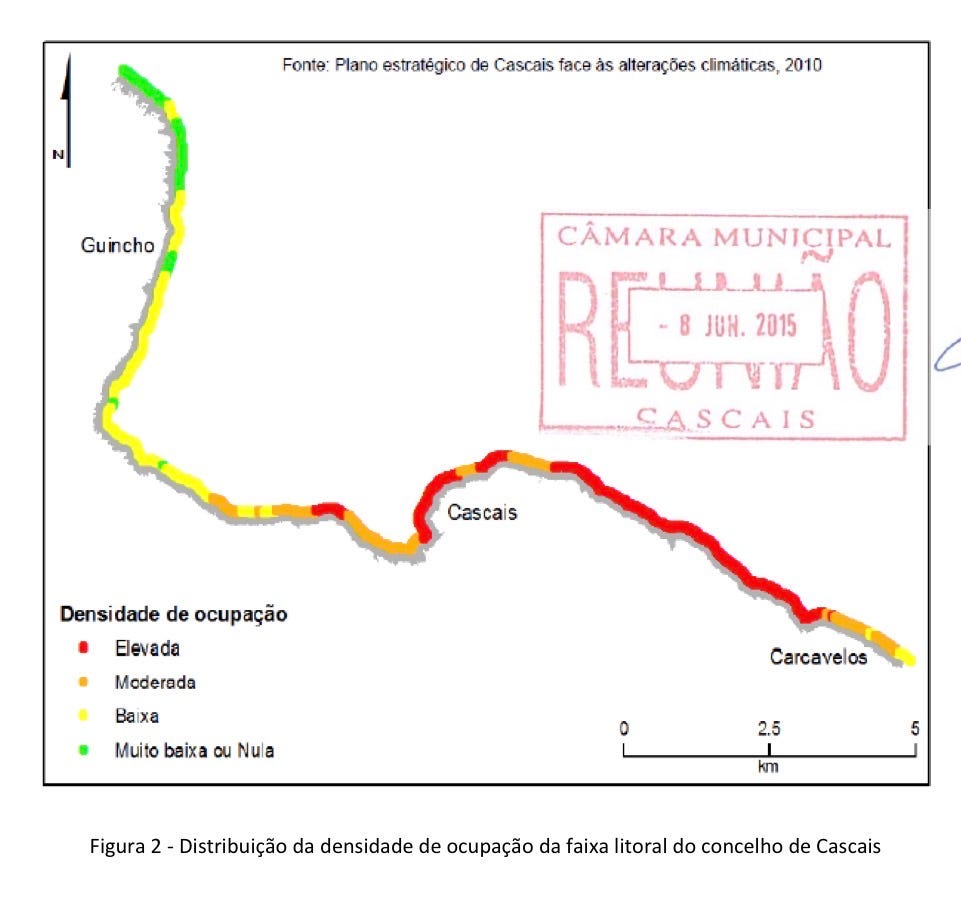
To understand what that means in practice, consider what the 1755 event actually did. A University of Porto seismic risk framework paper notes that in 1755, more than 50 percent of Lisbon’s building stock was heavily damaged or destroyed, and approximately 10 percent of the population perished. That happened with a city of roughly 200,000 people living almost entirely in unreinforced masonry. The building stock today is different, the population is larger, and the emergency systems are better. But a significant fraction of the older building stock remains, and that fraction is where the risk concentrates.
There are two ways this coast kills people, and they threaten different people differently.
In a major onshore or near shore earthquake, the shaking itself is what kills you. Buildings collapse, and the older the masonry construction, the worse it performs. Distance from the water is irrelevant here. What matters is your building.
In an offshore megaquake generating a tsunami, the shaking may be significant but the deadly part arrives later. In 1755, the first tsunami wave reached Lisbon approximately 40 to 60 minutes after the earthquake. A similar event today would give roughly the same window. The system kills people who do not recognize that the sea pulling back means a wall of water is coming, and people who are in low lying buildings at sea level when the waves arrive. In the Cascais and Estoril area, the coast faces the open Atlantic more directly than central Lisbon. Historical impact research shows the fatality rate in Cascais in 1755 approached 29 percent of its population. Along the Lisbon waterfront, the first tsunami surge pushed roughly 250 meters inland and reached an estimated run up of 12 meters. Contemporary accounts describe water rushing up the Tagus so fast that people on horseback near the docks were forced to gallop toward high ground.
Now I want to talk about buildings, because this is where your personal risk is most determined.
The single greatest factor in whether you survive a large earthquake on this coast is not where you live relative to the water. It is what you are living inside, and the different building generations here perform completely differently under shaking.
The oldest surviving structures predate the 1755 earthquake. These are stone masonry constructions with no seismic design intent whatsoever. They are rare in residential use now but exist in historic cores. In a strong earthquake they are the most dangerous category on this coast.

The Pombalino buildings, constructed after 1755, were built with what was then sophisticated seismic engineering. An internal wooden bracing system called the gaiola pombalina was designed to flex rather than collapse, combining the flexibility of timber with the fire resistance of masonry. These buildings perform better than their age suggests. The critical caveat, documented in research published in Structural Rehabilitation of Old Buildings, is that many have been modified over the centuries in ways that compromise the original design, with alterations to interior walls, addition of heavier floors, and removal of structural elements that were integral to how the gaiola system worked. A Pombalino building that looks intact from the street may have had its seismic resistance substantially degraded by previous owners.
The buildings constructed roughly from the mid 1800s through the 1920s, known as Gaioleiro construction, abandoned the earthquake resistant features of the Pombalino style in favor of taller and cheaper masonry. These are generally the most vulnerable residential structures on this coast. Research published in the Bulletin of Earthquake Engineering found that for this building type, under the standard seismic design scenario for Lisbon, there is approximately a 50 percent probability of heavy damage and approximately a 30 percent probability of collapse. If you live in an unreinforced masonry building from this era, that number deserves your full attention.
The buildings from roughly 1930 to 1960, sometimes called Placa construction, use masonry with reinforced concrete floor slabs. An improvement over the Gaioleiro generation, but still significantly more vulnerable than anything built after 1983. Post 1983 reinforced concrete buildings were built under Portugal’s first serious earthquake engineering code. Post 2010 buildings were designed under European Eurocode 8, which was fully enforced in Portugal since 2022. A properly constructed building from this era is substantially safer than anything older.
Now here is where it gets complicated, and I wonder how many people on this coast are making a mistake.
Walking through Estoril and Cascais, you see older buildings that look completely new. Fresh facades, renovated interiors, new windows, new kitchens. Many of these were marketed as renovated or rehabilitated properties. The question that almost nobody asks when buying one is what exactly was renovated. A cosmetic renovation, even a thorough and expensive one, does not change the seismic performance of the underlying structure. New tiles, new plumbing, new electrical, a repainted exterior: none of that strengthens a Gaioleiro frame. The building underneath the renovation is the same building it was before.
Portugal does have a legal mechanism under Eurocode 8 Part 3, the assessment and retrofitting framework, that can require seismic evaluation and strengthening when rehabilitation works cross certain thresholds of scale, cost, or structural intervention. The Portugal Post’s guide for foreign residents notes that permit checks are becoming stricter, particularly for pre 1950 buildings. But the threshold for triggering mandatory seismic assessment is not always reached in a typical renovation. A property developer who strips a building to its shell, installs new everything, and sells it as renovated may have done something genuinely beautiful without touching the structural system at all.
If you own or are considering buying a renovated older building on this coast, the questions that matter are specific. Was a structural engineering assessment conducted as part of the renovation? Were any seismic strengthening works performed on the load bearing walls, floors, or connections? Is there documentation from a licensed structural engineer confirming the works? If the answer to any of those is no or unknown, you are living in the same building that was there before, with a better kitchen.
For tsunami risk, elevation is your primary protection, and the terrain along this coast creates very sharp gradients. A 1755 scale event would generate waves reaching roughly 6 to 12 meters of run up along the Lisbon and Estoril coast based on historical records and modern modeling.
At sea level within 200 to 300 meters of the water, you are in the primary inundation zone. This includes beach level establishments, the Estoril boardwalk, the Cascais marina, and any property within a short sprint of the waterline. After a major earthquake, you have roughly 30 to 60 minutes before the first wave arrives. Whether you survive depends on whether you recognize the signal and move uphill immediately.
At 10 to 20 meters elevation, 300 to 500 meters from the water, you are in a partial buffer zone. A 12 meter run up can reach further inland than most people expect, particularly through streets or stream valleys that channel the water.
Above 30 meters of elevation, or on high ground inland, tsunami risk drops substantially. In Estoril, much of the residential area climbs the hillside above the coastal train line. If you live above that line at meaningful elevation, your tsunami exposure is low. I live in this range. The water is not what concerns me. My building is. For additional detail you can see this 2015 report that goes though multiple scenarios:
In the hills above Cascais, along the Sintra road corridor (up near N6-8), or anywhere inland of the coastal ridge, the tsunami is essentially not your problem. Your concern is the earthquake itself and what your building does.
Portugal has invested meaningfully in warning infrastructure. Cascais advanced its application for UNESCO Tsunami Ready certification in late 2025, making it one of the first municipalities in Portugal to pursue this designation. The system includes coastal sirens, digital panels, evacuation signage, and integration with IPMA, Portugal’s meteorological and seismic institute, which is an accredited tsunami service provider for the Northeast Atlantic.
Warning systems save lives when people know what to do with the warning. If you feel strong prolonged shaking while on or near the coast, that is your first alarm regardless of whether sirens have sounded. You move uphill immediately. The sea pulling back from the beach is not a curiosity. It is a run signal. Multiple waves follow the first, and the second is often larger. After evacuating, you do not return to low ground until authorities issue a formal all clear.
How does this coast compare to other high risk cities? Verisk AIR’s analysis and Lisbon’s own ReSist program materials place the city in a middle tier globally, clearly below Tokyo, Santiago, Wellington, and Taipei, which have completed or nearly completed citywide retrofit programs and have populations that have internalized earthquake preparedness culturally. But clearly above cities like Istanbul where tens of thousands of dangerous buildings remain unaddressed and political obstacles to retrofit are severe. The closest analogy is San Francisco before the major push following the 1989 Loma Prieta earthquake, combined with more functional early warning infrastructure for the tsunami threat specifically.
The city of Lisbon’s ReSist program is real, involving building level vulnerability assessment, educational campaigns, and prioritized intervention planning. But it is in progress rather than finished, which means the building next to yours may or may not have been evaluated yet.
Here is how I think about my own situation. I know my building, when it was built, what its structural system is, and roughly how it is likely to perform. I know my elevation and I know the route uphill from the waterfront. I have walked it. I know that the sea pulling back is a run signal. I know the indoor earthquake drill: drop, cover, hold until the shaking stops, because running outside during shaking puts you under falling facades. I keep water and basic supplies for several days. Here is an article on how to prepare.
Portugal’s leading seismologists are direct about this: the next large earthquake on this coast is not a question of if. The fault structures are loaded. The plates are moving. What differs between 1755 and the next event is not whether it happens but how many people die when it does. That number depends on building quality, public knowledge, warning infrastructure, and individual behavior, and all four are improvable.
This coast is worth living on. The hills above Sintra rise behind it, the Atlantic opens in front of it, and the light in the evenings does something to the air that I have not found anywhere else. The Portuguese people are amazing. Understanding the seismic reality beneath it does not diminish that. It just adds the layer of knowledge that anyone choosing to live in a place this beautiful and this geologically active ought to have.